A spatial analytical study to identify contextual drivers, constraints, and opportunities for future architectural intervention.


Project Context & Intent
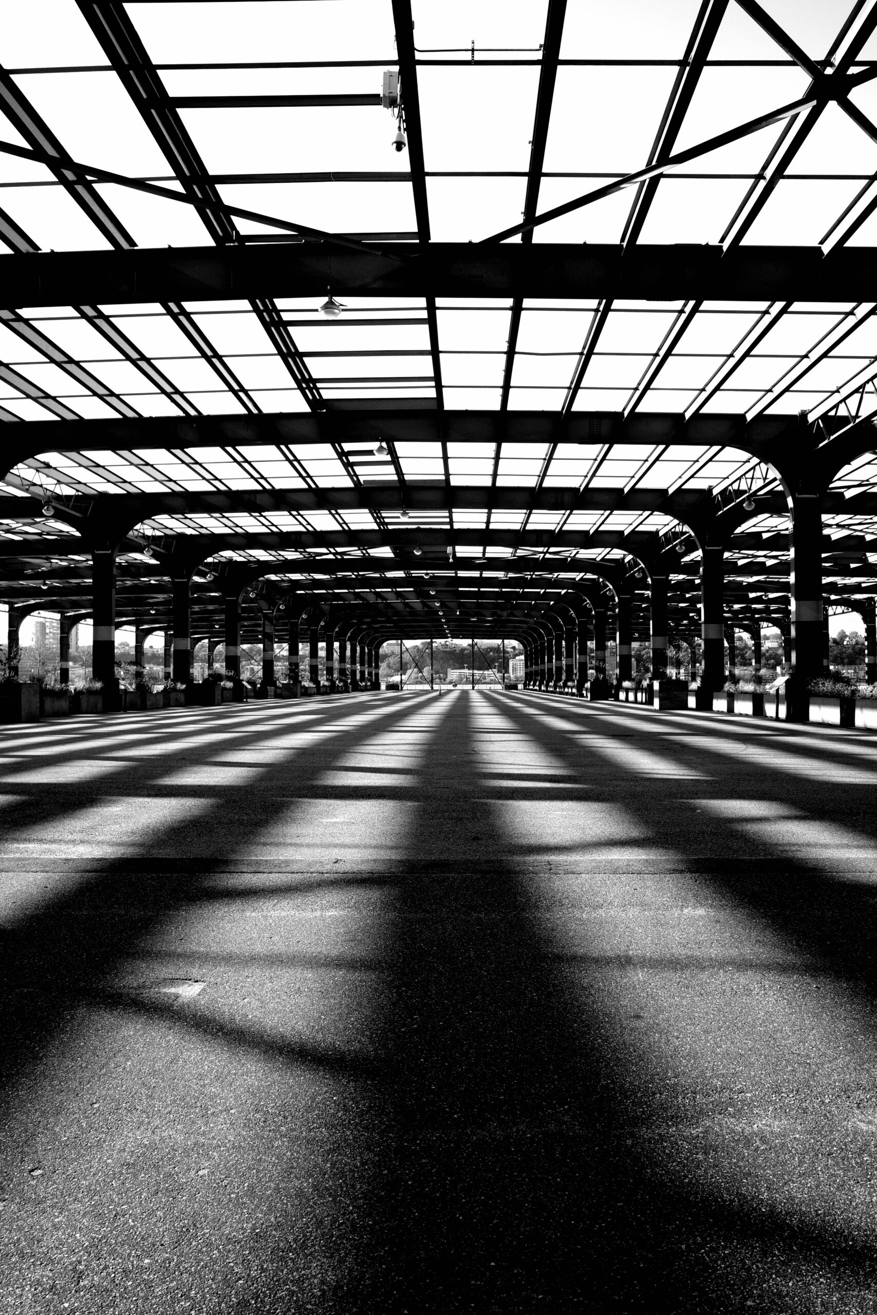
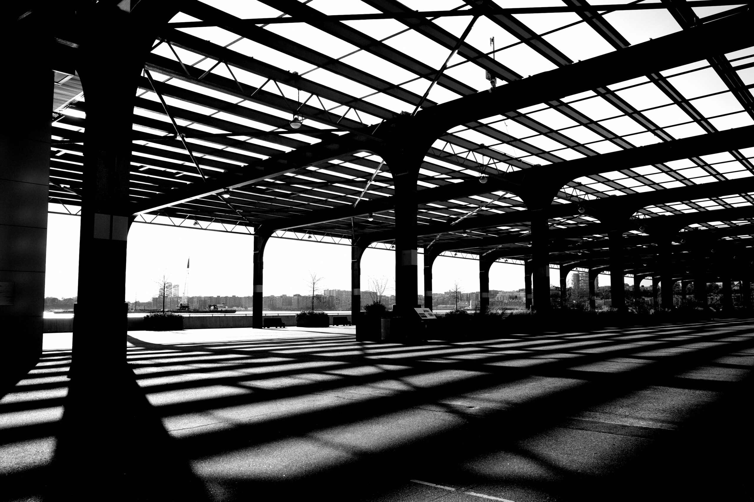
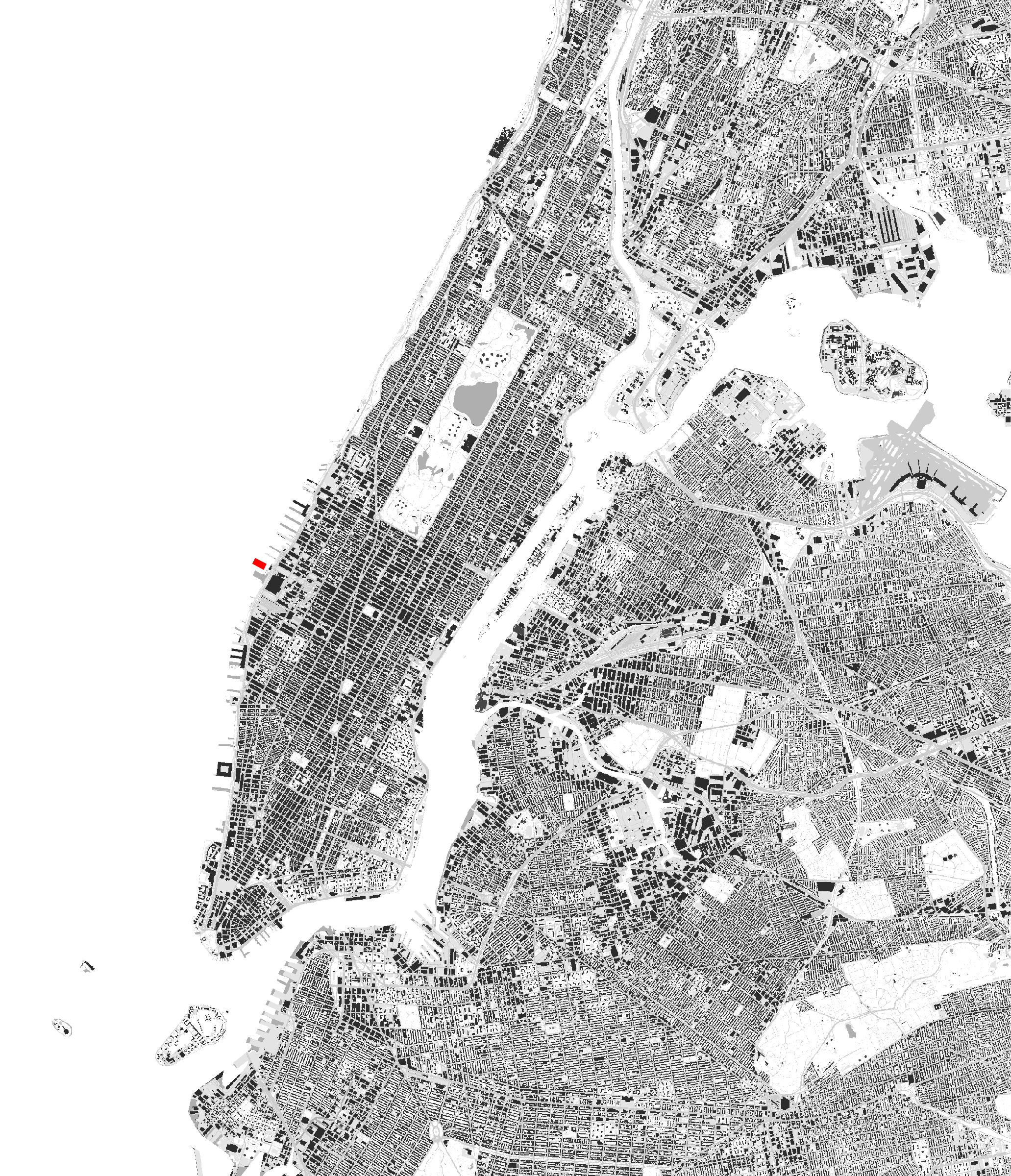
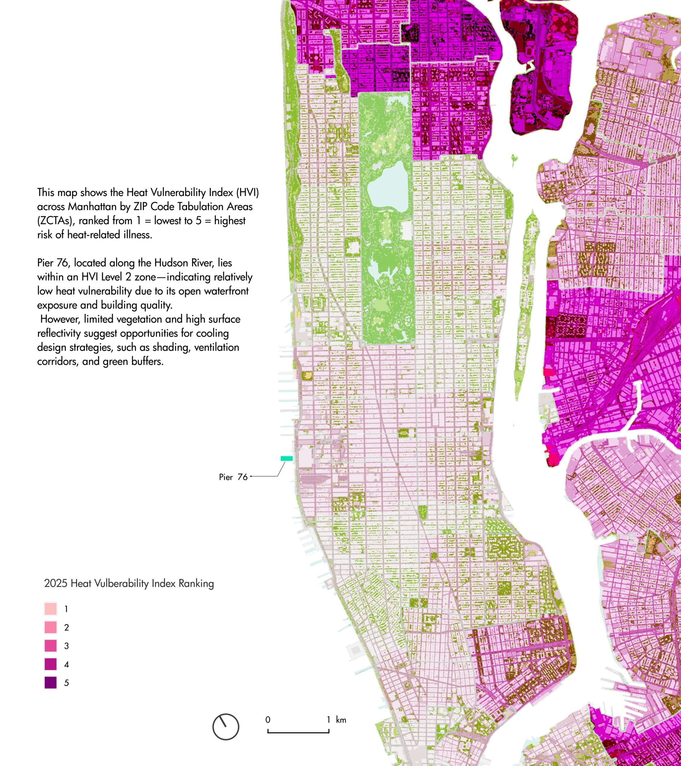
Pier 76 sits on Manhattan’s Hudson River waterfront and historically functioned as an NYPD tow pound rather than a public-facing asset, resulting in decades of underutilization despite its prime location. Following its transfer into the Hudson River Park system in 2021, the site now stands as a large, open steel-frame platform without clear long-term programming, suspended between former industrial use and future civic potential. Current planning interests emphasise public benefit, environmental responsibility, and context-specific development rather than generic commercialisation.
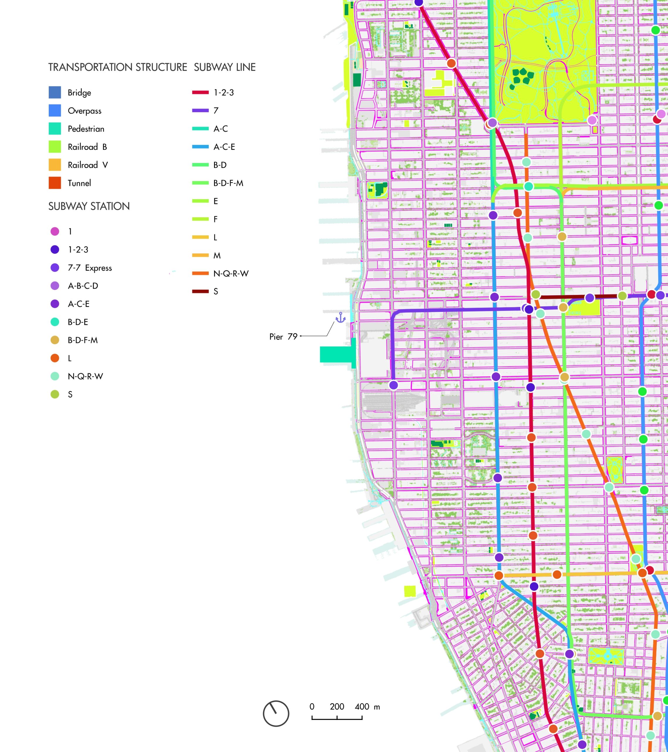
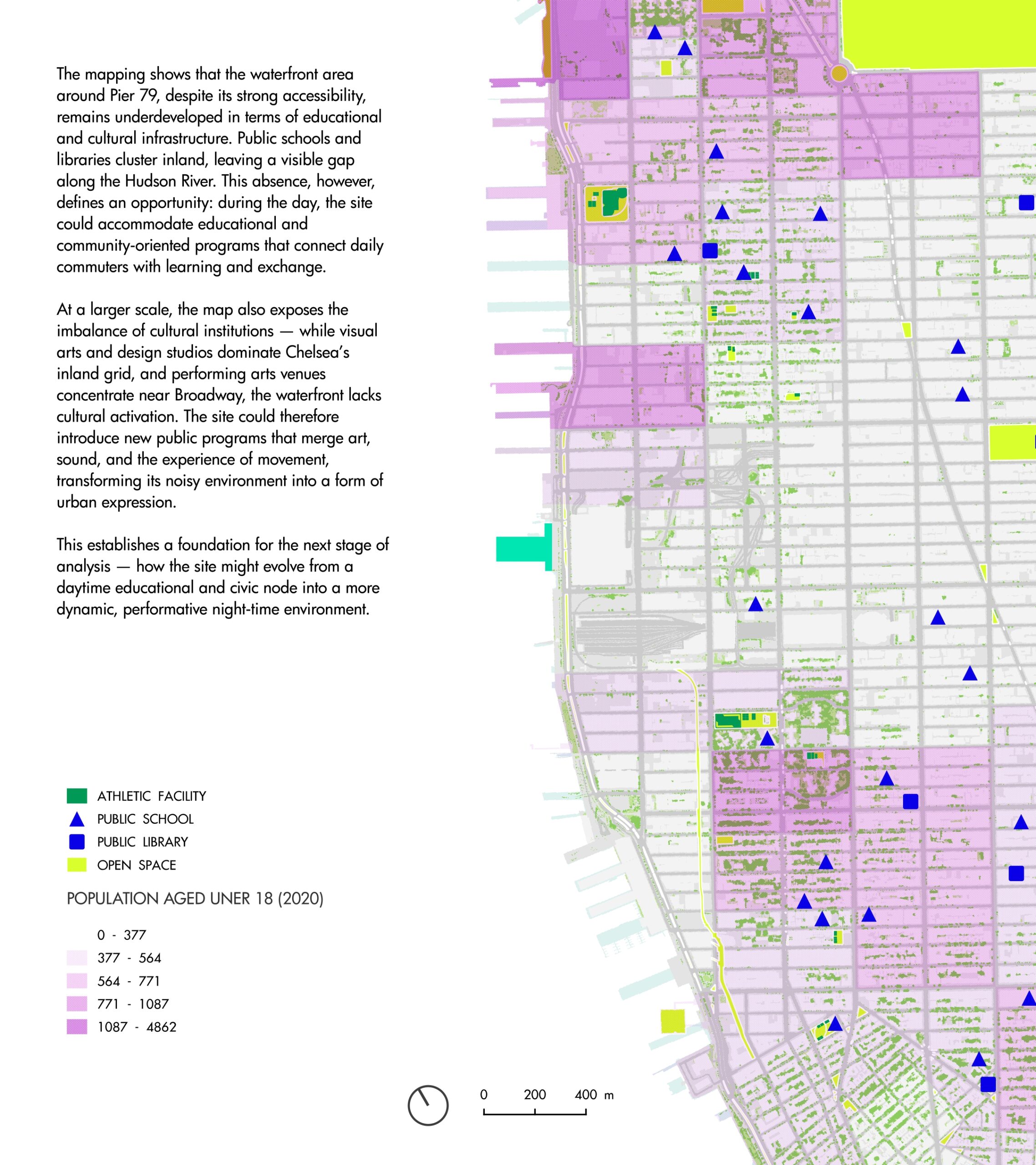
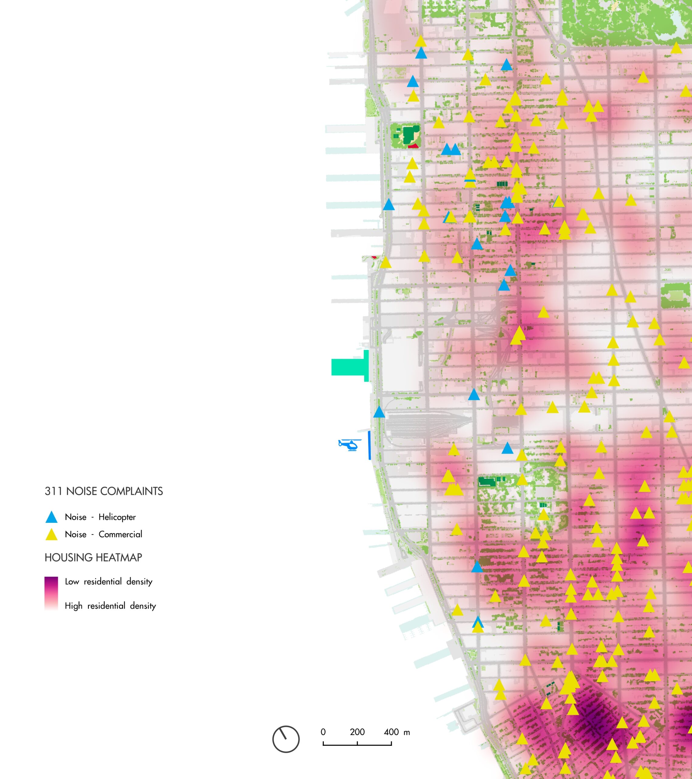
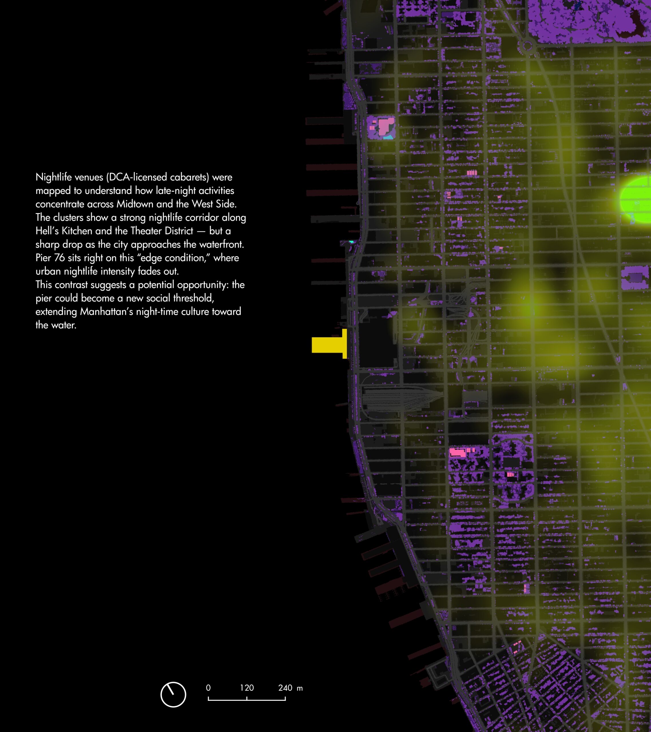
This atlas is created to re-read Pier 76 through data-driven urban investigation, using layered mapping of transportation networks, residential sensitivity, nighttime activity, noise exposure, and environmental vulnerability. Rather than proposing an immediate architectural form, the research seeks to identify spatial tensions, reveal hidden opportunities, and provide evidence-based direction for future adaptive reuse. The goal is to reposition Pier 76 not as a vacant leftover space, but as a strategic waterfront threshold capable of supporting new civic, cultural, and time-adaptive public programs that align with community needs, policy frameworks, and sustainable development ambitions.
Layered Urban Mapping & Spatial Findings
Data Source
• NYC Open Data — Department of City Planning (DCP)
• NYC Department of Buildings (DOB)
• NYC Department of Health and Mental Hygiene (DOHMH)
• NYC Department of Transportation (NYC DOT)
• NYC 311 Service Request Database
• Metropolitan Transportation Authority (MTA) — Transit Network & Stations
• Hudson River Park Trust (HRPT) — Pier 76 Legislation & Site Information
• U.S. Census Bureau — Demographic & Housing Data
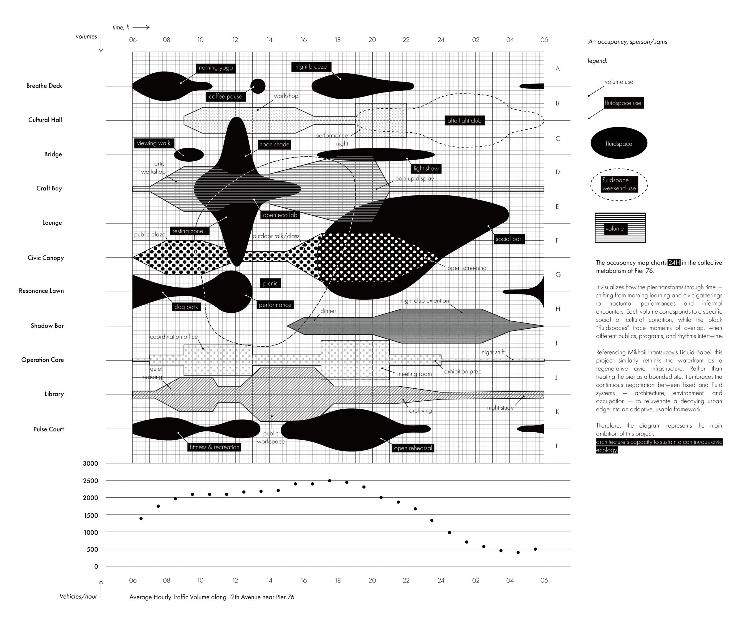
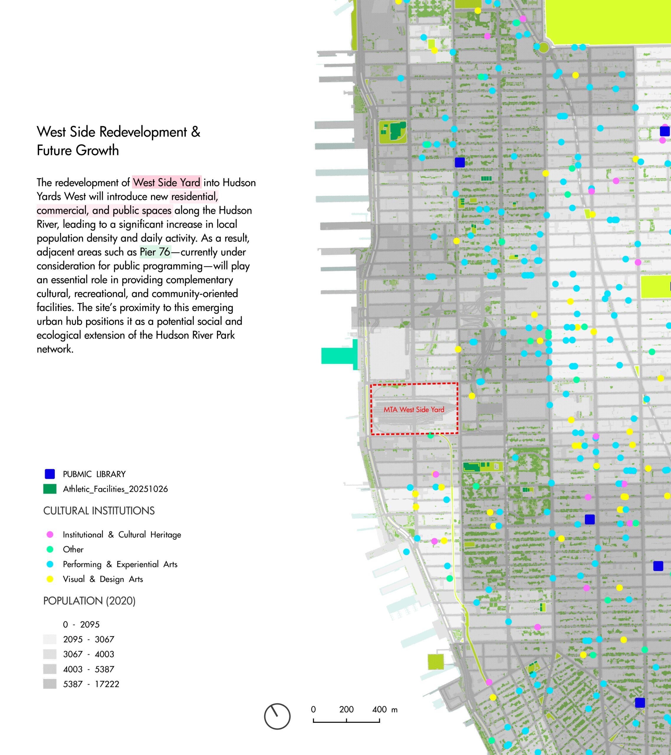
After unpacking Pier 76 through data-driven urban mapping, the question arises as to how this dormant structure can be transformed into a civic engine. The following masterplan synthesises the insights—from mobility flows to nighttime ecology and residential adjacency—into a site-specific spatial strategy that choreographs use, time, and atmosphere across the pier.
From Analytical Mapping → Spatial Strategy & Programmatic Framework